The observation and measurement of our earth is becoming increasingly accurate, producing huge amounts of data. This data can be helpful when it comes to solving social problems or even saving lives. In earthquake-prone regions, for example, the installation of an early warning system helps to prevent humanitarian disasters. Such situations are often time-critical. Governments and aid organizations operating with environmental data often have to resort to many different data sources. Data must be selected, scanned for its relevance and processed in time-consuming work steps.
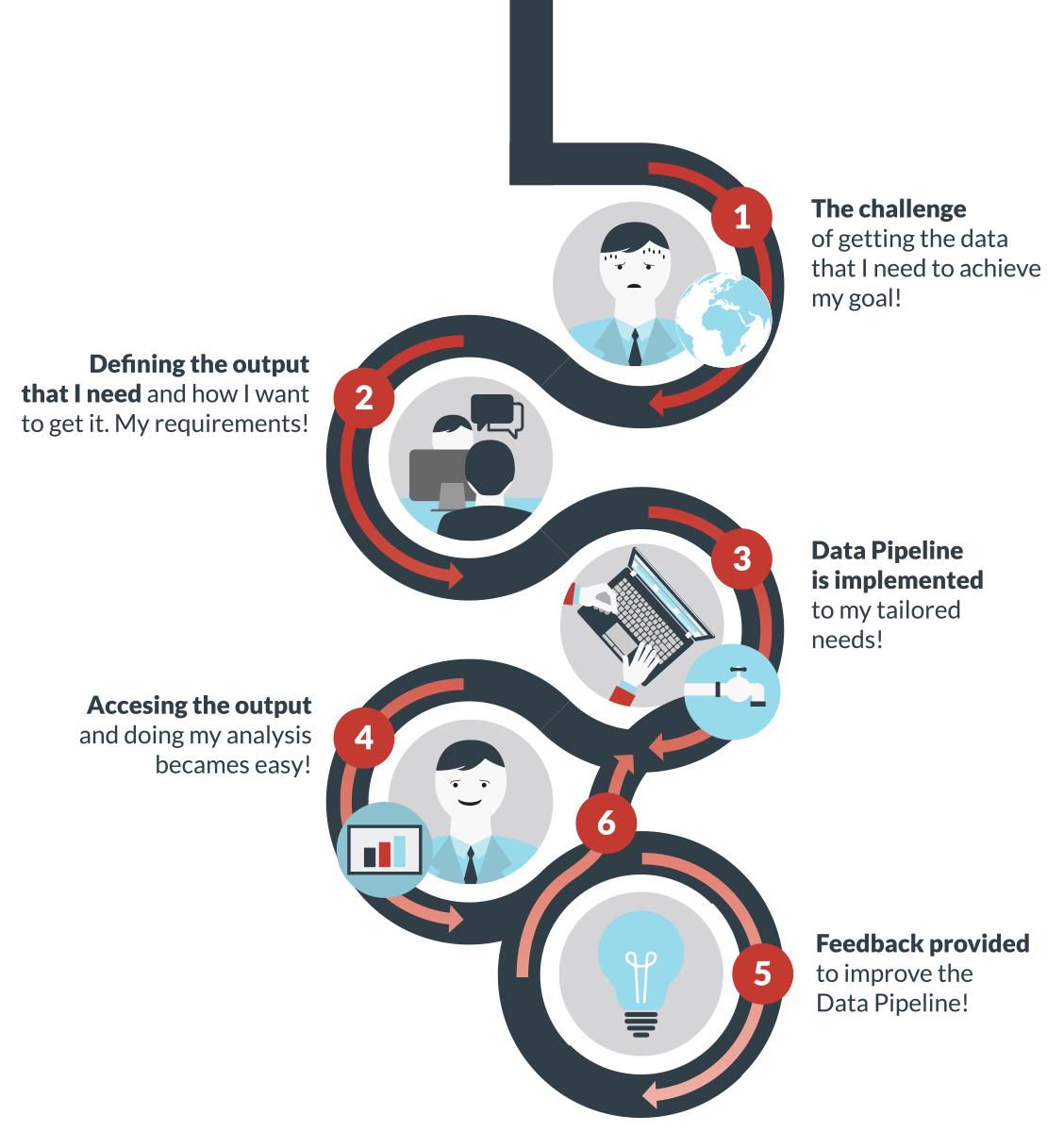
BETTER, short for Big Data Earth Observation Technology and Tools Enhancing Research and Development, is intended to help solving this problem. With the establishment of so-called data pipelines, extensive and highly heterogeneous data sets are processed in a clear and easily understandable manner. Which specific data sets are important for the individual users will be defined in workshops and hackathons. Once the data pipeline has been implemented, the entire process of data selection, preparation and processing is predetermined and users can fully concentrate on the evaluation.
Earth observation data are interesting for various sectors of society. Environmental, political, economic and infrastructure issues can be answered more easily and quickly by using data pipelines. For example, the United Nations World Food Programme in cooperation with BETTER can more accurately assess the consequences of humanitarian emergencies and thus plan the care for people more quickly and effectively. In addition to the cooperation with the WFP, BETTER also supports ETH Zurich in forecasting earthquakes, volcanic activities or subsidence. Moreover, BETTER helps the European Union Satellite Centre to further develop its expertise in the field of Geospatial Intelligence.
»BETTER will position itself in Big Data and Earth Observation application domains, using fora like the Fraunhofer Big Data Alliance to showcase the potential of EO data applications to solve existing challenges and identify new solutions«, says Dr. Simon Scerri, Senior Postdoctoral Researcher, Fraunhofer IAIS.
The data are provided by the Copernicus Earth Observation Programme. BETTER is a research project of the European Union and runs from November 2017 to October 2020, involving Terradue, the European Union Satellite Centre, the World Food Programme, ETH Zurich and Fraunhofer IAIS. The project is coordinated by Deimos, a company that provides high-technology engineering solutions and information systems.
 Fraunhofer Institute for Intelligent Analysis and Information Systems IAIS